
1921 Map of Rives Junction
USGS Topo · Published 1921About this map
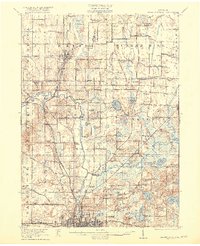
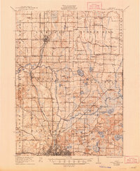
Jackson dominates the southern edge of this landscape, its urban grid contrasting with the agricultural townships of Rives, Henrietta, and Bunker Hill. The Michigan Central railroad serves as a vital artery, connecting the regional hub of Jackson to northern settlements like Leslie and the rail crossroads at Rives Junction. This era of development is marked by a dense network of country schools, including Bachelor School, Weeks School, and Felt Plain School, which anchored rural communities between the marshy reaches of Big Swamp and the Grand River.
Find a feature on this map
112 named features on this map. Tap any name to fly to it.
Don’t see what you’re looking for? This feature index may not catch every label — zoom into the map to look around manually.
Map Details
Editions of this 1921 Rives Junction Map
3 editions found
Other maps of this area

1908 · Fowlerville
USGS Topo · 1:62,500

1909 · Mason
USGS Topo · 1:62,500

1910 · Fowlerville
USGS Topo · 1:62,500

1910 · Lansing
USGS Topo · 1:62,500

1911 · Mason
USGS Topo · 1:62,500

1912 · Lansing
USGS Topo · 1:62,500

1919 · Stockbridge
USGS Topo · 1:62,500

1919 · Springport
USGS Topo · 1:62,500

1919 · Rives Junction
USGS Topo · 1:62,500

1921 · Springport
USGS Topo · 1:62,500