Loading...
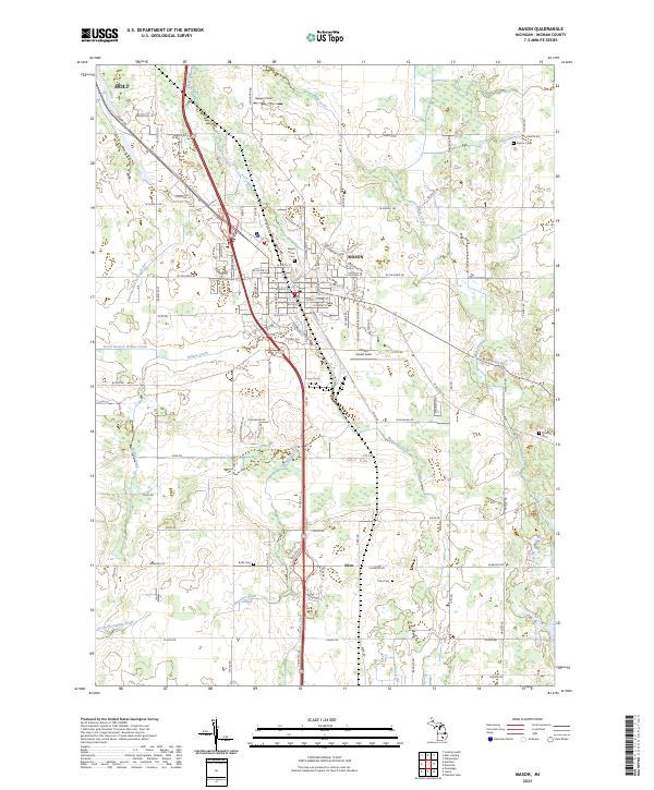
Loading map...1909 Map of Mason
USGS Topo · Published 1965About this map
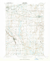
The city of Mason and the developing outskirts of East Lansing anchor this 1909 survey of Ingham County. The region's transport network is exceptionally dense, featuring several major rail lines including the Michigan Central Railroad (Lansing Division) and the Pere Marquette RR. A unique era of transportation is preserved through the Lansing and Pine Lake Electric line running near Haslett and Pine Lake.
Find a feature on this map
86 named features on this map. Tap any name to fly to it.
Don’t see what you’re looking for? This feature index may not catch every label — zoom into the map to look around manually.
Map Details
Date Portrayed1909
Date Published1965
PublisherU.S. Geological Survey
Map TypeTopographic
Scale1:62,500
Physical Dimensions17 x 20.8 inches
Editions of this 1909 Mason Map
This is the sole edition of this map. No revisions or reprints were ever made.
Historical Maps of Lansing Through Time
8 maps found
Featured Locations
Source Details
SourceU.S. Geological Survey
CopyrightPublic Domain