
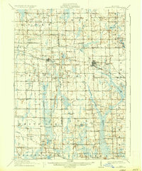
1910 Map of Fowlerville
USGS Topo · Published 1910About this map
The Cedar River and its various branches, including the West Branch Cedar River and Middle Branch Cedar River, form the primary drainage system for this 1910 landscape across the Ingham and Livingston county line. Small agricultural hubs like Webberville, Fowlerville, and White Oak serve as the principal centers of commerce and social life. The transit network is dominated by the Pere Marquette RR and the Detroit and Grand Rapids Line, which parallel each other through the central corridor, facilitating the movement of local goods and passengers.
Find a feature on this map
80 named features on this map. Tap any name to fly to it.
Don’t see what you’re looking for? This feature index may not catch every label — zoom into the map to look around manually.
Map Details
Editions of this 1910 Fowlerville Map
2 editions found
Other maps of this area

1902 · Dexter
USGS Topo · 1:62,500

1904 · Ann Arbor
USGS Topo · 1:125,000

1906 · Dexter
USGS Topo · 1:62,500

1907 · Howell
USGS Topo · 1:62,500

1908 · Ann Arbor
USGS Topo · 1:125,000

1908 · Fowlerville
USGS Topo · 1:62,500

1909 · Howell
USGS Topo · 1:62,500

1909 · Mason
USGS Topo · 1:62,500

1911 · Mason
USGS Topo · 1:62,500

1919 · Stockbridge
USGS Topo · 1:62,500