
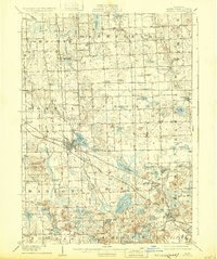
1909 Map of Howell
USGS Topo · Published 1909About this map
The Howell and Brighton corridor in Livingston County is anchored by a significant railway intersection where the Pere Marquette RR crosses the Ann Arbor RR. This network supported a landscape of scattered rural hamlets and institutional landmarks, notably the State Sanitarium southwest of the Howell town center. The map captures the early automotive era along the Grand River Road (Detroit and Grand Rapids Line), which served as a primary artery between major Michigan cities long before the modern interstate system.
Find a feature on this map
84 named features on this map. Tap any name to fly to it.
Don’t see what you’re looking for? This feature index may not catch every label — zoom into the map to look around manually.
Map Details
Editions of this 1909 Howell Map
2 editions found
Other maps of this area

1902 · South Lyon
USGS Topo · 1:62,500

1902 · Dexter
USGS Topo · 1:62,500

1904 · Ann Arbor
USGS Topo · 1:125,000

1906 · Dexter
USGS Topo · 1:62,500

1906 · South Lyon
USGS Topo · 1:62,500

1907 · Howell
USGS Topo · 1:62,500

1908 · Ann Arbor
USGS Topo · 1:125,000

1908 · Fowlerville
USGS Topo · 1:62,500

1909 · Milford
USGS Topo · 1:62,500

1910 · Fowlerville
USGS Topo · 1:62,500
Featured Places
- Hamburg Township, MI
- Genoa Charter Township, MI
- Green Oak Charter Township, MI
- Brighton Charter Township, MI
- Hartland Township, MI