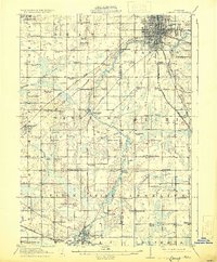
1912 Map of Lansing
USGS Topo · Published 1931About this map
The Grand River and Cedar River converge at Lansing, anchoring a landscape transitioning from the state capital's urban grid to a dense network of rural schoolhouse districts and farming hamlets. This 1909–1910 survey documents a high concentration of local educational landmarks, from the Canada Settlement School in the west to the Tobias School and Baker School near the city limits. These schools, often spaced just a few miles apart, indicate the robust township-based social structure of the early twentieth century.
Find a feature on this map
97 named features on this map. Tap any name to fly to it.
Don’t see what you’re looking for? This feature index may not catch every label — zoom into the map to look around manually.
Map Details
Editions of this 1912 Lansing Map
4 editions found
Other maps of this area

1909 · Mason
USGS Topo · 1:62,500

1910 · Lansing
USGS Topo · 1:62,500

1911 · Mason
USGS Topo · 1:62,500

1912 · Lansing
USGS Topo · 1:62,500

1919 · Springport
USGS Topo · 1:62,500

1919 · Rives Junction
USGS Topo · 1:62,500

1921 · Rives Junction
USGS Topo · 1:62,500

1921 · Springport
USGS Topo · 1:62,500

1921 · Marshall
USGS Topo · 1:62,500

1923 · Marshall
USGS Topo · 1:62,500