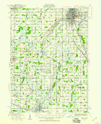
1983 Map of Lansing
USGS Topo · Published 1984About this map
The Lansing metropolitan area and the sprawling campus of Michigan State University serve as the central hub of this 1980s regional study. The landscape is defined by the convergence of the Grand River, Looking Glass River, and Red Cedar River, which historically dictated the growth of settlements like Grand Ledge, Eaton Rapids, and Portland. Outside the urban center, the map reveals a well-developed network of small farming communities and market towns connected by the Chesapeake and Ohio and Grand Trunk Western railroads.
Find a feature on this map
155 named features on this map. Tap any name to fly to it.
Don’t see what you’re looking for? This feature index may not catch every label — zoom into the map to look around manually.
Map Details
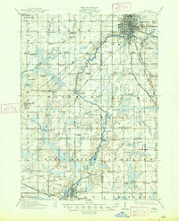
Editions of this 1983 Lansing Map
This is the sole edition of this map. No revisions or reprints were ever made.