
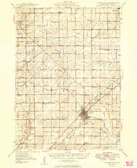
1949 Map of Charlotte
USGS Topo · Published 1949About this map
The city of Charlotte sits at the nexus of the Michigan Central and Grand Trunk railroads, serving as a hub for the surrounding agricultural townships in the late 1940s. The landscape is characterized by a dense network of rural one-room schoolhouses, including the Roxand Center Sch, Watson Sch, and Strange Sch, reflecting a decentralized educational system before the widespread consolidation of Michigan's rural districts.
Find a feature on this map
92 named features on this map. Tap any name to fly to it.
Don’t see what you’re looking for? This feature index may not catch every label — zoom into the map to look around manually.
Map Details
Editions of this 1949 Charlotte Map
3 editions found
Other maps of this area

1910 · Lansing
USGS Topo · 1:62,500

1912 · Lansing
USGS Topo · 1:62,500

1916 · Ionia
USGS Topo · 1:62,500

1918 · Battle Creek
USGS Topo · 1:62,500

1918 · Ionia
USGS Topo · 1:62,500

1919 · Springport
USGS Topo · 1:62,500

1921 · Springport
USGS Topo · 1:62,500

1921 · Marshall
USGS Topo · 1:62,500

1923 · Marshall
USGS Topo · 1:62,500

1927 · De Witt
USGS Topo · 1:62,500