
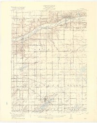
1918 Map of Ionia
USGS Topo · Published 1918About this map
The Grand River corridor anchors this 1918 survey, where the river valley supports a high concentration of institutional landmarks including the State Reformatory, State Prison, and State Hospital near Ionia. The landscape is a well-ordered grid of agricultural townships such as Berlin and Odessa, punctuated by dozens of one-room schoolhouses like Welch School and Loomis School that served the rural population.
Find a feature on this map
92 named features on this map. Tap any name to fly to it.
Don’t see what you’re looking for? This feature index may not catch every label — zoom into the map to look around manually.
Map Details
Editions of this 1918 Ionia Map
2 editions found
Other maps of this area

1916 · Ionia
USGS Topo · 1:62,500

1918 · Lowell
USGS Topo · 1:62,500

1943 · Ionia
USGS Topo · 1:62,500

1943 · Lowell
USGS Topo · 1:62,500

1945 · Portland
USGS Topo · 1:62,500

1949 · Charlotte
USGS Topo · 1:62,500

1950 · Nashville
USGS Topo · 1:62,500

1951 · Nashville
USGS Topo · 1:62,500

1951 · Hastings
USGS Topo · 1:62,500

1954 · Midland
USGS Topo · 1:250,000