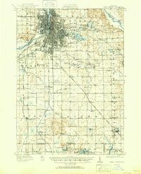
1961 Map of Grand Rapids
USGS Topo · Published 1961About this map
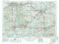
The Grand River and Thornapple River systems anchor this 1961 view of Southern Michigan, revealing the mid-century industrial and transport network connecting major population centers. The map documents the sprawling footprints of Grand Rapids, Lansing, Kalamazoo, Battle Creek, and Jackson before the full maturation of the interstate highway system. This era's infrastructure is defined by a dense web of rail lines, including the Pennsylvania RR and New York Central RR, which still serviced small manufacturing towns like Albion and Marshall.
Find a feature on this map
186 named features on this map. Tap any name to fly to it.
Don’t see what you’re looking for? This feature index may not catch every label — zoom into the map to look around manually.
Map Details
Editions of this 1961 Grand Rapids Map
This is the sole edition of this map. No revisions or reprints were ever made.
Historical Maps of Grand Rapids Through Time
6 maps found