
1962 Map of Chattanooga
USGS Topo · Published 1964About this map
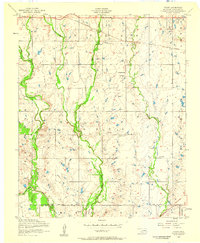
Chattanooga and Faxon serve as the primary hubs in this southwestern Oklahoma landscape, where the borders of Tillman, Comanche, and Cotton counties converge. The geography is defined by a dense network of waterways, most notably Deep Red Creek and Beaver Creek, which drain the agricultural plains. Significant local landmarks include the Chattanooga Airport and several community institutions such as the Ahpeatone Sch and Bible Ch, reflecting a rural society built around small-town centers and crossroads schools.
Find a feature on this map
31 named features on this map. Tap any name to fly to it.
Don’t see what you’re looking for? This feature index may not catch every label — zoom into the map to look around manually.
Map Details
Editions of this 1962 Chattanooga Map
This is the sole edition of this map. No revisions or reprints were ever made.
Other maps of this area

1937 · Cache
USGS Topo · 1:48,000

1942 · Cache
USGS Topo · 1:62,500

1946 · Lawton
USGS Topo · 1:62,500

1950 · Snyder
USGS Topo · 1:62,500

1955 · Lawton
USGS Topo · 1:250,000

1956 · Post Oak Creek
USGS Topo · 1:24,000
1956 · Taupa
USGS Topo · 1:24,000

1956 · Lawton
USGS Topo · 1:24,000

1956 · Indiahoma
USGS Topo · 1:24,000
1956 · Cache
USGS Topo · 1:62,500