2024 Map of Cheraw
USGS Topo · Published 2024About this map
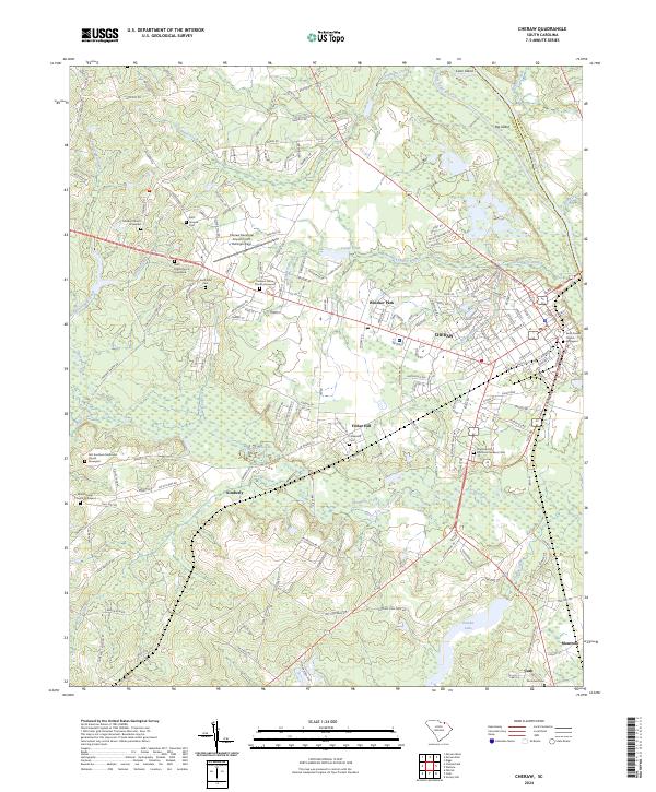
Cheraw sits along the west bank of the Pee Dee River, serving as a historic hub where the coastal plain meets the inland sandhills. The landscape is defined by the winding course of Thompson Creek and its many tributaries, including Huckleberry Branch and Beaver Creek. This modern survey reveals a dense concentration of local history markers, particularly surrounding the town center and suburban areas like Windsor Park and Fisher Hill. Numerous burial grounds such as Saint Davids Church Graveyard and Chatham Hill Memorial Gardens Cem offer significant touchpoints for genealogical research. The map also detail the presence of the Cheraw Municipal Airport/Lynch Bellinger Field and the surrounding agricultural tracts toward Cash and Montrose. To the north, the terrain rises toward Gopher Hill, while the eastern boundary follows the river toward Marlboro Co, highlighting the enduring importance of the river corridor to the regional geography.
Find a feature on this map
173 named features on this map. Tap any name to fly to it.
Don’t see what you’re looking for? This feature index may not catch every label — zoom into the map to look around manually.
Map Details
Editions of this 2024 Cheraw Map
This is the sole edition of this map. No revisions or reprints were ever made.
