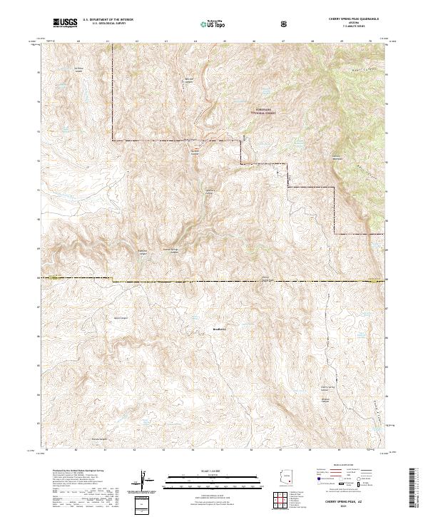
2021 Map of Cherry Spring Peak
USGS Topo · Published 2021About this map
Coronado National Forest defines the high-altitude geography of this map, where the southern reaches of the Galiuro Mountains rise above the surrounding desert floor. This landscape is a complex system of drainage and relief, centered on the prominent Cherry Spring Peak. Water, the region's most precious resource, is meticulously documented through numerous named points such as Stone Cabin Spring, Eureka Spring, and Salcita Spring, indicating the vital importance of these locations for both wildlife and human activity in an arid environment. The small settlement of Bradberry sits at the nexus of several canyon systems, including Aguja Canyon and Sycamore Canyon. Access through this backcountry is facilitated by the West Divide Trl and Mitchell Canyon Trl, which provide the primary transit through the steep terrain and connect various watershed basins like Redfield Canyon and Bass Canyon.
Find a feature on this map
46 named features on this map. Tap any name to fly to it.
Don’t see what you’re looking for? This feature index may not catch every label — zoom into the map to look around manually.
Map Details
Editions of this 2021 Cherry Spring Peak Map
This is the sole edition of this map. No revisions or reprints were ever made.
Other maps of this area

1938 · Galiuro Mts
USGS Topo · 1:48,000

1940 · Sierra Bonita Ranch
USGS Topo · 1:62,500

1942 · Sierra Bonita Ranch
USGS Topo · 1:62,500

1943 · Galiuro Mts
USGS Topo · 1:62,500

1943 · Sierra Bonita Ranch
USGS Topo · 1:62,500

1943 · Winchester Mts.
USGS Topo · 1:62,500

1945 · Redington
USGS Topo · 1:62,500

1945 · Winchester Mts.
USGS Topo · 1:62,500

1956 · Tucson
USGS Topo · 1:250,000

1957 · Redington
USGS Topo · 1:62,500