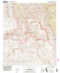
1996 Map of Cherry Spring Peak
USGS Topo · Published 2003About this map
Galiuro Mountains terrain dominates this 1996 survey of the Arizona backcountry, where the Graham and Cochise County line cuts through high-elevation wilderness. The landscape is defined by its extensive network of drainages, including Redfield Canyon, Sycamore Canyon, and Cherry Spring Canyon, which support isolated springs and water sources vital to the region's history. Settlement is sparse, represented by isolated landmarks like Jackson Cabin, Pride Ranch, and Browning Ranch.
Find a feature on this map
45 named features on this map. Tap any name to fly to it.
Don’t see what you’re looking for? This feature index may not catch every label — zoom into the map to look around manually.
Map Details
Editions of this 1996 Cherry Spring Peak Map
This is the sole edition of this map. No revisions or reprints were ever made.
Other maps of this area

1938 · Galiuro Mts
USGS Topo · 1:48,000

1940 · Sierra Bonita Ranch
USGS Topo · 1:62,500

1942 · Sierra Bonita Ranch
USGS Topo · 1:62,500

1943 · Galiuro Mts
USGS Topo · 1:62,500

1943 · Sierra Bonita Ranch
USGS Topo · 1:62,500

1943 · Winchester Mts.
USGS Topo · 1:62,500

1945 · Redington
USGS Topo · 1:62,500

1945 · Winchester Mts.
USGS Topo · 1:62,500

1956 · Tucson
USGS Topo · 1:250,000

1957 · Redington
USGS Topo · 1:62,500