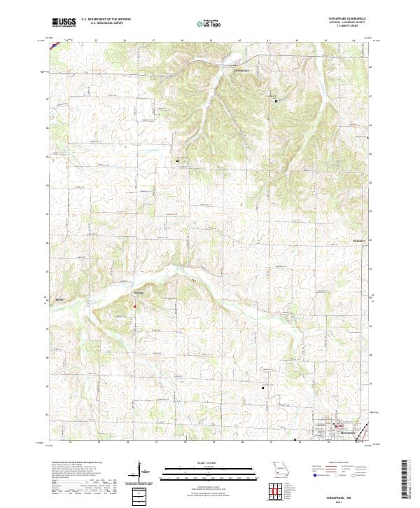
2021 Map of Chesapeake
USGS Topo · Published 2021About this map
Chesapeake and several other rural communities dot the landscape of Lawrence County in this 2021 update, reflecting the modern layout of this Missouri agricultural region. The map reveals a dense network of county roads, such as Lawrence 2130 and State Hwy K, connecting small settlements like Orange and McKinley. Genealogy and local history researchers will find the specific locations of historic family and community burial grounds, including Campground Cem and Brashers Cem, which remain as permanent markers of early settlement patterns.
Find a feature on this map
77 named features on this map. Tap any name to fly to it.
Don’t see what you’re looking for? This feature index may not catch every label — zoom into the map to look around manually.
Map Details
Editions of this 2021 Chesapeake Map
This is the sole edition of this map. No revisions or reprints were ever made.