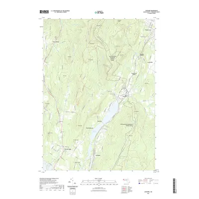
2021 Map of Cheshire
USGS Topo · Published 2021About this map
The Hoosic River valley forms the industrial and residential spine of this Berkshire County landscape, where the long-established settlements of Cheshire and Berkshire sit alongside the Cheshire Reservoir. The area's transport evolution is evident in the Ashuwillticook Rail Trl, which follows the historic path of the railroad through the valley floor. To the west, the steep rises of the Taconic Range dominate the horizon, while the eastern heights are traversed by the Appalachian National Scenic Trl near The Cobbles. This contemporary survey also highlights numerous burial sites for genealogical research, including the Center Cem in Lanesborough and the North Cem near the town center. The map reveals a transition from the dense village clusters of Maple Grove and Arnoldville to the high-elevation peaks like Saddle Ball Mtn and Jones Nose.
Find a feature on this map
126 named features on this map. Tap any name to fly to it.
Don’t see what you’re looking for? This feature index may not catch every label — zoom into the map to look around manually.
Map Details
Editions of this 2021 Cheshire Map
This is the sole edition of this map. No revisions or reprints were ever made.
Other maps of this area

1886 · Greylock
USGS Topo · 1:62,500

1886 · Becket
USGS Topo · 1:62,500

1888 · Becket
USGS Topo · 1:62,500

1888 · Berlin
USGS Topo · 1:62,500

1888 · Pittsfield
USGS Topo · 1:62,500

1890 · Pittsfield
USGS Topo · 1:62,500

1890 · Berlin
USGS Topo · 1:62,500

1891 · Greylock
USGS Topo · 1:62,500

1893 · Becket
USGS Topo · 1:62,500

1893 · Greylock
USGS Topo · 1:62,500