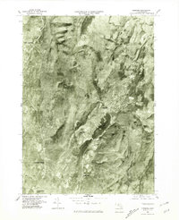
1975 Map of Cheshire
USGS Topo · Published 1981About this map
Cheshire Reservoir serves as a central focal point for this 1975 aerial study of Berkshire County, reflecting the industrial and agricultural patterns of the late twentieth century. This orthophotograph, produced by the Geological Survey, offers a distinct perspective of the narrow valley floor where the Hoosic River flows through Adams and Cheshire. The visual data reveals the density of residential and commercial development in the settlements of Lanesborough and Farnams compared to the more open, wooded terrain surrounding New Ashford in the northwest. To the south, the map captures the northern edge of Pontoosuc Lake and the community of Berkshire, documenting the land use and drainage patterns of the Green River watershed before further modern development altered the local landscape.
Find a feature on this map
10 named features on this map. Tap any name to fly to it.
Don’t see what you’re looking for? This feature index may not catch every label — zoom into the map to look around manually.
Map Details
Editions of this 1975 Cheshire Map
This is the sole edition of this map. No revisions or reprints were ever made.
Other maps of this area

1886 · Greylock
USGS Topo · 1:62,500

1886 · Becket
USGS Topo · 1:62,500

1888 · Becket
USGS Topo · 1:62,500

1888 · Berlin
USGS Topo · 1:62,500

1888 · Pittsfield
USGS Topo · 1:62,500

1890 · Pittsfield
USGS Topo · 1:62,500

1890 · Berlin
USGS Topo · 1:62,500

1891 · Greylock
USGS Topo · 1:62,500

1893 · Becket
USGS Topo · 1:62,500

1893 · Greylock
USGS Topo · 1:62,500