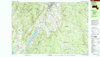
1998 Map of Cheshire
USGS Topo · Published 2000About this map
Stafford Hill rises above a landscape defined by significant conservation areas and early industrial corridors in this late-century depiction of the Northern Berkshires. The community of Cheshire serves as a central hub, flanked by the expansive Cheshire Reservoir and the Conrail line that follows the valley floor. To the west, the Mt Greylock State Reservation and the winding Appalachian Trail emphasize the region's long-standing role as a recreational and ecological preserve.
Find a feature on this map
90 named features on this map. Tap any name to fly to it.
Don’t see what you’re looking for? This feature index may not catch every label — zoom into the map to look around manually.
Map Details
Editions of this 1998 Cheshire Map
This is the sole edition of this map. No revisions or reprints were ever made.
Other maps of this area

1886 · Greylock
USGS Topo · 1:62,500

1886 · Hawley
USGS Topo · 1:62,500

1886 · Chesterfield
USGS Topo · 1:62,500

1886 · Becket
USGS Topo · 1:62,500

1888 · Becket
USGS Topo · 1:62,500

1888 · Berlin
USGS Topo · 1:62,500

1888 · Chesterfield
USGS Topo · 1:62,500

1888 · Pittsfield
USGS Topo · 1:62,500

1890 · Hawley
USGS Topo · 1:62,500

1890 · Pittsfield
USGS Topo · 1:62,500