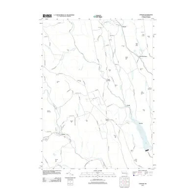
2012 Map of Chester
USGS Topo · Published 2012About this map
The Middle Br Westfield River and Little River carve through a landscape of named hills and rural communities in this western Massachusetts upland. The settlement at Chester serves as a primary hub, while smaller hamlets like South Worthington, North Chester, and Ringville are scattered across the terrain. Numerous family-named burial grounds, including Old Leonard Cem, Gate Cem, and Converse Cem, suggest deep genealogical roots in the area. The eastern portion of the map is dominated by the waters of Littleville Lake, which is fed by Still Brook and Day Brook. Significant elevations like Gobble Mountain and Hickory Mountain rise above the stream valleys, while Glendale Falls marks a notable hydraulic feature. Local agriculture and land use are evident through features like the Ireland Street Orchard, providing a clear view of the regional character before the modern era's most recent developments.
Find a feature on this map
119 named features on this map. Tap any name to fly to it.
Don’t see what you’re looking for? This feature index may not catch every label — zoom into the map to look around manually.
Map Details
Editions of this 2012 Chester Map
This is the sole edition of this map. No revisions or reprints were ever made.
Other maps of this area

1886 · Chesterfield
USGS Topo · 1:62,500

1886 · Becket
USGS Topo · 1:62,500

1887 · Granville
USGS Topo · 1:62,500

1888 · Becket
USGS Topo · 1:62,500

1888 · Sandisfield
USGS Topo · 1:62,500

1888 · Chesterfield
USGS Topo · 1:62,500

1889 · Granville
USGS Topo · 1:62,500

1893 · Granville
USGS Topo · 1:62,500

1893 · Chesterfield
USGS Topo · 1:62,500

1893 · Becket
USGS Topo · 1:62,500