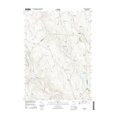
2015 Map of Chester
USGS Topo · Published 2015About this map
The Middle Branch Westfield River carves a deep valley through this western Massachusetts landscape, defining the corridor for settlements like North Chester and Dayville. In the southern portion of the sheet, the village of Chester sits at a historic crossroads where Blair Brook and Sanderson Brook meet the river's path. The terrain is notably punctuated by numerous small family and community burial grounds, including the Old Leonard Cem, Gate Cem, and Pine Hill Cem, which offer significant value for genealogical research in Hampshire and Hampden Counties.
Find a feature on this map
112 named features on this map. Tap any name to fly to it.
Don’t see what you’re looking for? This feature index may not catch every label — zoom into the map to look around manually.
Map Details
Editions of this 2015 Chester Map
This is the sole edition of this map. No revisions or reprints were ever made.
Other maps of this area

1886 · Chesterfield
USGS Topo · 1:62,500

1886 · Becket
USGS Topo · 1:62,500

1887 · Granville
USGS Topo · 1:62,500

1888 · Becket
USGS Topo · 1:62,500

1888 · Sandisfield
USGS Topo · 1:62,500

1888 · Chesterfield
USGS Topo · 1:62,500

1889 · Granville
USGS Topo · 1:62,500

1893 · Granville
USGS Topo · 1:62,500

1893 · Chesterfield
USGS Topo · 1:62,500

1893 · Becket
USGS Topo · 1:62,500