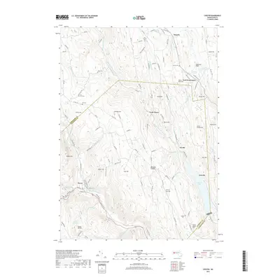
2018 Map of Chester
USGS Topo · Published 2018About this map
The Middle Br Westfield River and its numerous tributaries carve a complex drainage pattern through this Hampshire and Hampden County borderlands. The settlement of Chester serves as a local focal point, positioned near the West Branch Westfield River and the Csx rail line. To the east, the impounded waters of Littleville Lake dominate the valley floor near the village of Littleville.
Find a feature on this map
121 named features on this map. Tap any name to fly to it.
Don’t see what you’re looking for? This feature index may not catch every label — zoom into the map to look around manually.
Map Details
Editions of this 2018 Chester Map
This is the sole edition of this map. No revisions or reprints were ever made.
Other maps of this area

1886 · Chesterfield
USGS Topo · 1:62,500

1886 · Becket
USGS Topo · 1:62,500

1887 · Granville
USGS Topo · 1:62,500

1888 · Becket
USGS Topo · 1:62,500

1888 · Sandisfield
USGS Topo · 1:62,500

1888 · Chesterfield
USGS Topo · 1:62,500

1889 · Granville
USGS Topo · 1:62,500

1893 · Granville
USGS Topo · 1:62,500

1893 · Chesterfield
USGS Topo · 1:62,500

1893 · Becket
USGS Topo · 1:62,500