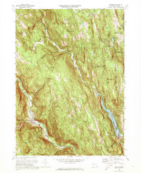
1972 Map of Chester
USGS Topo · Published 1973About this map
Littleville Lake and the Middle Branch Westfield River valley dominate this early 1970s survey of the Massachusetts highlands. The landscape reflects a transition from traditional agricultural settlements to managed conservation areas, including the Chester Wildlife Management Area and the Chester-Blandford State Forest. Industrial and transportation history is concentrated in the southwest corner where the Penn Central railroad follows the West Branch Westfield River through Chester. Genealogists will find numerous family and local burial grounds preserved here, such as Old Leonard Cem, Gate Cem, and Riley Grove Cem. The topography is punctuated by distinctive peaks like Gobble Mtn and Bear Mtn, while water features like Glendale Falls and the Littleville Dam show the area's complex drainage and modern water management. Small clusters like South Worthington and North Chester remain connected by winding country roads that follow the contours of the Berkshires.
Find a feature on this map
64 named features on this map. Tap any name to fly to it.
Don’t see what you’re looking for? This feature index may not catch every label — zoom into the map to look around manually.
Map Details
Editions of this 1972 Chester Map
2 editions found
Other maps of this area

1886 · Chesterfield
USGS Topo · 1:62,500

1886 · Becket
USGS Topo · 1:62,500

1887 · Granville
USGS Topo · 1:62,500

1888 · Becket
USGS Topo · 1:62,500

1888 · Sandisfield
USGS Topo · 1:62,500

1888 · Chesterfield
USGS Topo · 1:62,500

1889 · Granville
USGS Topo · 1:62,500

1893 · Granville
USGS Topo · 1:62,500

1893 · Chesterfield
USGS Topo · 1:62,500

1893 · Becket
USGS Topo · 1:62,500