2024 Map of Chunchula
USGS Topo · Published 2024About this map
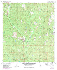
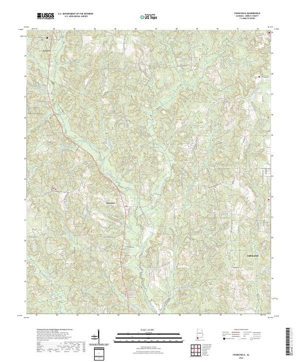
Chickasaw Creek meanders southward through this portion of Mobile County, defining a landscape of complex drainage systems and small-scale settlement. The unincorporated community of Chunchula serves as a central point, situated along the Old Citronelle Hwy and St Stephens Rd. To the north, the settlement of Gulfcrest is marked by the Gulfcrest Cem, while the northwestern edge of Saraland appears in the southeast near Hells Swamp Branch. This map documents a transition from rural timberlands and creek bottoms toward suburban expansion.
Find a feature on this map
67 named features on this map. Tap any name to fly to it.
Don’t see what you’re looking for? This feature index may not catch every label — zoom into the map to look around manually.
Map Details
Editions of this 2024 Chunchula Map
This is the sole edition of this map. No revisions or reprints were ever made.