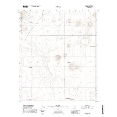
2018 Map of Cinder Hill
USGS Topo · Published 2018About this map
The Pedregosa Mountains dominate the northwestern corner of this landscape, giving way to the broad expanse of the San Bernardino Valley in southeastern Cochise County. This arid environment is defined by an intricate network of seasonal drainages, including Hackberry Wash, Danger Wash, and the ominously named Deadmans Wash. The presence of several cattle tanks such as Moore Tank, Silo Tank, and Wells Tank underscores the importance of managed water resources for ranching operations in this high-desert region. At the center of the survey lies Cinder Hill, a distinct volcanic feature that rises above the surrounding flats. Transport through this desert corridor is traced by the path of Silver Creek Rd, which follows the general course of Silver Cr as it flows toward the Black Draw.
Find a feature on this map
22 named features on this map. Tap any name to fly to it.
Don’t see what you’re looking for? This feature index may not catch every label — zoom into the map to look around manually.
Map Details
Editions of this 2018 Cinder Hill Map
This is the sole edition of this map. No revisions or reprints were ever made.
Other maps of this area

1917 · Chiricahua
USGS Topo · 1:125,000

1919 · Perilla
USGS Topo · 1:125,000

1919 · Chiricahua
USGS Topo · 1:125,000

1922 · McDonald
USGS Topo · 1:62,500

1926 · Pedregosa
USGS Topo · 1:62,500

1940 · Apache
USGS Topo · 1:62,500

1940 · College Peaks
USGS Topo · 1:62,500

1955 · Douglas
USGS Topo · 1:250,000

1958 · Apache
USGS Topo · 1:62,500

1958 · Guadalupe Canyon
USGS Topo · 1:62,500