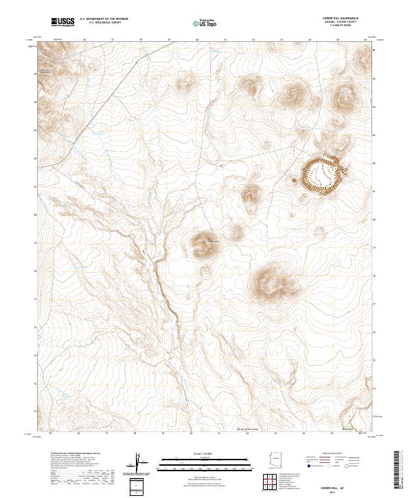
2021 Map of Cinder Hill
USGS Topo · Published 2021About this map
The San Bernardino Valley landscape is defined by its arid drainage systems and volcanic topography, captured here in the early twenty-first century. Dominating the central terrain is Cinder Hill, a prominent volcanic feature surrounded by an intricate network of seasonal watercourses. These desert washes, including Deadmans Wash, Hackberry Wash, and Wildcat Wash, dictate the movement of water and travelers across this part of Cochise County.
Find a feature on this map
22 named features on this map. Tap any name to fly to it.
Don’t see what you’re looking for? This feature index may not catch every label — zoom into the map to look around manually.
Map Details
Editions of this 2021 Cinder Hill Map
This is the sole edition of this map. No revisions or reprints were ever made.
Other maps of this area

1917 · Chiricahua
USGS Topo · 1:125,000

1919 · Perilla
USGS Topo · 1:125,000

1919 · Chiricahua
USGS Topo · 1:125,000

1922 · McDonald
USGS Topo · 1:62,500

1926 · Pedregosa
USGS Topo · 1:62,500

1940 · Apache
USGS Topo · 1:62,500

1940 · College Peaks
USGS Topo · 1:62,500

1955 · Douglas
USGS Topo · 1:250,000

1958 · Apache
USGS Topo · 1:62,500

1958 · Guadalupe Canyon
USGS Topo · 1:62,500