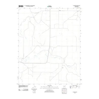
2010 Map of Clapham
USGS Topo · Published 2010About this map
Pinabetes Creek and its many winding tributaries define this portion of Union County, New Mexico, illustrating a landscape primarily dedicated to ranching at the beginning of the 21st century. The map centers on the small community of Clapham, where County Rd C029 and Clapham Rd converge. Further north, the settlement of Thomas sits along County Hwy C-042, serving as a focal point for the surrounding rural territory. The map is notably dotted with established agricultural holdings such as Sowers Ranch in the northeast corner and Holland Ranch to the southeast, emphasizing the enduring pastoral economy of the High Plains. Surface water features like Garcia Creek and Leon Creek cut through the terrain, providing essential drainage in this arid region where the road network follows the section lines of the traditional township grid.
Find a feature on this map
15 named features on this map. Tap any name to fly to it.
Don’t see what you’re looking for? This feature index may not catch every label — zoom into the map to look around manually.
Map Details
Editions of this 2010 Clapham Map
This is the sole edition of this map. No revisions or reprints were ever made.
Other maps of this area

1954 · Dalhart
USGS Topo · 1:250,000

1958 · Dalhart
USGS Topo · 1:250,000

1962 · Dalhart
USGS Topo · 1:250,000

1966 · Skull Mesa
USGS Topo · 1:24,000

1966 · Pedernal Creek
USGS Topo · 1:24,000

1966 · Tate School
USGS Topo · 1:24,000

1966 · Clapham
USGS Topo · 1:24,000

1966 · Car Top Butte
USGS Topo · 1:24,000

1966 · Sand Hill
USGS Topo · 1:24,000

1970 · Stead
USGS Topo · 1:24,000