
Loading...
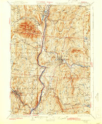
Loading map...1926 Map of Claremont
USGS Topo · Published 1955About this map
The Connecticut River serves as the central artery of this 1926 survey, dividing the townships of eastern Vermont from their New Hampshire neighbors. The landscape is defined by the industrial hubs of Claremont and Springfield, where the Sugar River and Black River powered early manufacturing. Notable transport infrastructure of the era is well-documented, including the historic Cornish Bridge and the Ashleys Ferry crossing south of Weathersfield Bow.
Find a feature on this map
124 named features on this map. Tap any name to fly to it.
Don’t see what you’re looking for? This feature index may not catch every label — zoom into the map to look around manually.
Map Details
Date Portrayed1926
Date Published1955
PublisherU.S. Geological Survey
Map TypeTopographic
Scale1:62,500
Physical Dimensions17 x 20.8 inches
Editions of this 1926 Claremont Map
This is the sole edition of this map. No revisions or reprints were ever made.
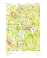
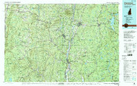
Historical Maps of Claremont Through Time
4 maps found
Featured Locations
Source Details
SourceU.S. Geological Survey
CopyrightPublic Domain