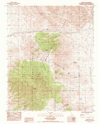
1985 Map of Clark Mtn.
USGS Topo · Published 1985About this map
Clark Mountain Range dominates this desert landscape, where mineral extraction and scarce water sources define the human geography of the mid-1980s. The map highlights a series of significant mining operations, including the Stonewall Mine, Taylor Mine, and Colosseum Mine, clustered near the high peaks and deep canyons like Greens Canyon. These sites, along with the Copper World Mine to the south, indicate a legacy of prospecting in the region's complex geological formations.
Find a feature on this map
30 named features on this map. Tap any name to fly to it.
Don’t see what you’re looking for? This feature index may not catch every label — zoom into the map to look around manually.
Map Details
Editions of this 1985 Clark Mtn. Map
This is the sole edition of this map. No revisions or reprints were ever made.
Other maps of this area

1910 · Ivanpah
USGS Topo · 1:250,000

1912 · Ivanpah
USGS Topo · 1:250,000

1942 · Ivanpah
USGS Topo · 1:250,000

1947 · Kingman
USGS Topo · 1:250,000

1948 · Kingman
USGS Topo · 1:250,000

1954 · Kingman
USGS Topo · 1:250,000

1955 · Kingman
USGS Topo · 1:250,000

1955 · Mescal Range
USGS Topo · 1:62,500

1955 · Roach Lake
USGS Topo · 1:62,500

1956 · Ivanpah
USGS Topo · 1:62,500