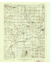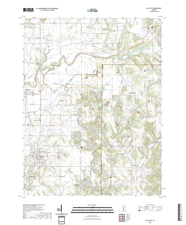
1908 Map of Clay City
USGS Topo · Published 1908About this map
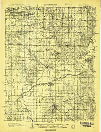
The Eel River and its complex drainage network, including Birch Creek and Splunge Creek, define this 1908 landscape in Clay and Vigo counties. This era reveals a dense rural infrastructure of small schoolhouses and churches that served scattered farming and mining communities. A significant concentration of schools like Scrubby Oak School and Dutch Knob School appear alongside the development of Sugar Ridge. Industrial activity is marked by an extensive rail system, including the Vandalia RR and the Chicago Indianapolis and Louisville RR, which facilitated movement between the county seat and smaller settlements like Saline City and Middlebury. Notable historical landmarks include the National Pike in the north and the Feeder Dam Bridge, reflecting a transition in regional transportation from early pioneer routes to the peak of the steam rail age.
Find a feature on this map
98 named features on this map. Tap any name to fly to it.
Don’t see what you’re looking for? This feature index may not catch every label — zoom into the map to look around manually.
Map Details
Editions of this 1908 Clay City Map
This is the sole edition of this map. No revisions or reprints were ever made.
Historical Maps of Seelyville Through Time
9 maps found