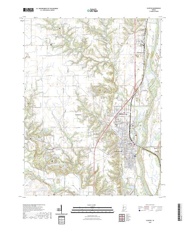
2022 Map of Clinton
USGS Topo · Published 2022About this map
Clinton and its surrounding riverfront communities define this landscape along the Wabash River, where the Vermillion Co and Parke Co line follows the active waterway. The residential clusters of Fairview Park, Crompton Hill, and Sandytown sit nestled against the river's western terrace, connected by the CSX Transportation rail line that parallels the valley. Further west, the terrain rises toward Brouilletts Bluff, giving way to a rural grid of county roads such as W Co Rd 1000 S and Co Rd 1780 S.
Find a feature on this map
103 named features on this map. Tap any name to fly to it.
Don’t see what you’re looking for? This feature index may not catch every label — zoom into the map to look around manually.
Map Details
Editions of this 2022 Clinton Map
This is the sole edition of this map. No revisions or reprints were ever made.
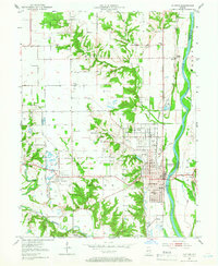
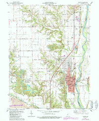
Historical Maps of Klondyke Through Time
3 maps found