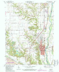
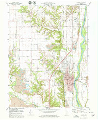
1978 Map of Clinton
USGS Topo · Published 1987About this map
The industrial and residential landscape of Clinton dominates this survey, where the Wabash River serves as a natural boundary between Vermillion and Parke counties. The map documents a significant era of heavy surface extraction, with numerous strip mines and gravel pits like Summit Grove surrounding the town. These mining operations sit in close proximity to established neighborhoods and rural outposts such as Centenary, Klondyke, and Sandytown.
Find a feature on this map
46 named features on this map. Tap any name to fly to it.
Don’t see what you’re looking for? This feature index may not catch every label — zoom into the map to look around manually.
Map Details
Editions of this 1978 Clinton Map
2 editions found
Other maps of this area

1947 · Ridge Farm
USGS Topo · 1:62,500

1947 · Paris
USGS Topo · 1:62,500

1949 · Paris
USGS Topo · 1:62,500

1950 · Rosedale
USGS Topo · 1:24,000

1950 · New Goshen
USGS Topo · 1:24,000

1950 · Sandford
USGS Topo · 1:24,000

1951 · Clinton
USGS Topo · 1:24,000

1951 · Mecca
USGS Topo · 1:24,000

1951 · Saint Bernice
USGS Topo · 1:24,000

1953 · Indianapolis
USGS Topo · 1:250,000