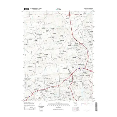
2014 Map of Cockeysville
USGS Topo · Published 2014About this map
Cockeysville and its surrounding suburbs in Baltimore County are characterized by a dense network of residential estates and legacy settlements during this 2014 survey. The landscape is defined by the rolling terrain of Chestnut Ridge and the broad Worthington Valley, where suburban growth meets preserved open spaces. Prominent institutional and community landmarks are scattered throughout the region, including Stevenson Univ and the sprawling grounds of Druid Ridge Cem. Hydrological features like Jones Falls, Beaverdam Run, and the Pikesville Reservoir anchor the local geography, reflecting the area's importance to the regional water network. Long-standing communities such as Texas and Ashland sit alongside modern developments like Hunt Valley, illustrating the evolution from rural crossroads to an integrated suburban corridor. Family-named landmarks like Jonathans Delight and Hunt Cup Hill preserve the historical character of the hunt country even as the region has become a major northern hub.
Find a feature on this map
367 named features on this map. Tap any name to fly to it.
Don’t see what you’re looking for? This feature index may not catch every label — zoom into the map to look around manually.
Map Details
Editions of this 2014 Cockeysville Map
This is the sole edition of this map. No revisions or reprints were ever made.
Other maps of this area

1892 · Ellicott
USGS Topo · 1:62,500

1894 · Ellicott
USGS Topo · 1:62,500

1894 · Baltimore
USGS Topo · 1:62,500

1899 · Baltimore
USGS Topo · 1:62,500

1900 · Parkton
USGS Topo · 1:62,500

1902 · Parkton
USGS Topo · 1:62,500

1904 · Baltimore
USGS Topo · 1:62,500

1905 · Westminster
USGS Topo · 1:62,500

1906 · Ellicott
USGS Topo · 1:62,500

1908 · Patapsco
USGS Topo · 1:125,000