2023 Map of College Place
USGS Topo · Published 2023About this map
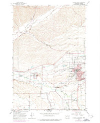
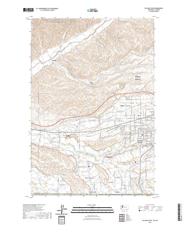
The Whitman Mission National Historic Site serves as a focal point of this region, preserving the location of the Great Grave and marking a significant chapter in the movement of people through the Walla Walla Valley. The landscape is defined by an intricate network of water management and natural drainages, including the Whitman Ditch, Burlingame Ditch, and the Walla Walla River. This irrigation and hydraulic infrastructure supports the surrounding agricultural character, connecting the communities of College Place, Mojonnier, and Garrett.
Find a feature on this map
126 named features on this map. Tap any name to fly to it.
Don’t see what you’re looking for? This feature index may not catch every label — zoom into the map to look around manually.
Map Details
Editions of this 2023 College Place Map
This is the sole edition of this map. No revisions or reprints were ever made.