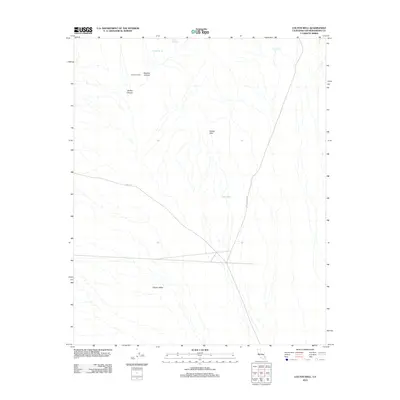
2012 Map of Colton Well
USGS Topo · Published 2012About this map
The arid landscape of eastern San Bernardino County is documented in this 2012 survey, centered on the Colton Hills and the surrounding desert basins. Water sources, often the only anchors for human activity in this terrain, are clearly marked including Whiskey Spring, Domingo Spring, and Cave Spring. The presence of the Seven IL Ranch in the northern portion of the quadrangle suggests the continued importance of livestock grazing in these open lands. Transportation through the area is limited to primary corridors like Essex Rd and Black Canyon Rd, which intersect near the historic Colton Well. This intersection of routes and water points illustrates the traditional movement patterns across Clipper Valley, where topography like Beecher Canyon and Barber Canyon dictated the paths of early travelers and ranchers alike.
Find a feature on this map
11 named features on this map. Tap any name to fly to it.
Don’t see what you’re looking for? This feature index may not catch every label — zoom into the map to look around manually.
Map Details
Editions of this 2012 Colton Well Map
This is the sole edition of this map. No revisions or reprints were ever made.
Other maps of this area

1910 · Ivanpah
USGS Topo · 1:250,000

1912 · Ivanpah
USGS Topo · 1:250,000

1942 · Ivanpah
USGS Topo · 1:250,000

1942 · Amboy
USGS Topo · 1:250,000

1943 · Amboy
USGS Topo · 1:250,000

1947 · Kingman
USGS Topo · 1:250,000

1948 · Kingman
USGS Topo · 1:250,000

1954 · Needles
USGS Topo · 1:250,000

1954 · Kingman
USGS Topo · 1:250,000

1955 · Kingman
USGS Topo · 1:250,000