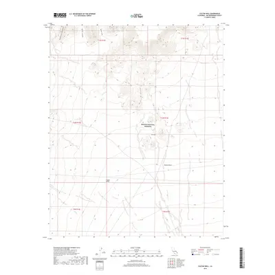
2018 Map of Colton Well
USGS Topo · Published 2018About this map
The Mojave National Preserve encompasses a significant portion of this high-desert landscape, where the Providence Mountains and the Colton Hills rise above the surrounding terrain. Vital water sources are concentrated in the northern canyons, including Whiskey Spring, Domingo Spring, and Cave Spring. The presence of Colton Well at the base of the hills highlights the historical importance of localized water points in the arid Mojave Desert. The map reveals a transition from these upland features into the broad, sloping expanse of Clipper Valley to the south. This modern survey detail shows the persistent reliance on these specific natural springs and wells for land management and navigation within the protected desert ecosystem, illustrating the geographic relationship between high-relief canyons like Barber Canyon and the valley floor.
Find a feature on this map
17 named features on this map. Tap any name to fly to it.
Don’t see what you’re looking for? This feature index may not catch every label — zoom into the map to look around manually.
Map Details
Editions of this 2018 Colton Well Map
This is the sole edition of this map. No revisions or reprints were ever made.
Other maps of this area

1910 · Ivanpah
USGS Topo · 1:250,000

1912 · Ivanpah
USGS Topo · 1:250,000

1942 · Ivanpah
USGS Topo · 1:250,000

1942 · Amboy
USGS Topo · 1:250,000

1943 · Amboy
USGS Topo · 1:250,000

1947 · Kingman
USGS Topo · 1:250,000

1948 · Kingman
USGS Topo · 1:250,000

1954 · Needles
USGS Topo · 1:250,000

1954 · Kingman
USGS Topo · 1:250,000

1955 · Kingman
USGS Topo · 1:250,000