2023 Map of Columbia City
USGS Topo · Published 2023About this map
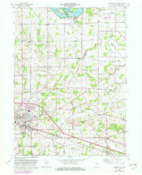
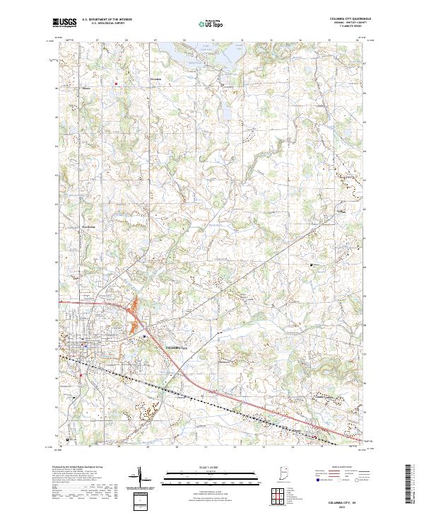
The Whitley County Courthouse stands at the heart of Columbia City, the civic and economic center of this modern survey of Whitley County. The landscape is defined by the convergence of the Blue River and the Eel River, which wind through the southern and central sections of the quadrangle. North of the city, the terrain transitions into a glacial lake district featuring Tri-Lakes, Shriner Lake, and Little Cedar Lake. This area is marked by a complex network of man-made drainage, including Rittenhouse Ditch and Mowrey Ditch, illustrating the intensive agricultural management of the Indiana countryside. Outside the main town, smaller settlements like Collins and Coesse anchor rural intersections, while Terrys Airport and cemeteries such as Garrison Cem and South Park Cem provide specific points of interest for local history and genealogical research.
Find a feature on this map
136 named features on this map. Tap any name to fly to it.
Don’t see what you’re looking for? This feature index may not catch every label — zoom into the map to look around manually.
Map Details
Editions of this 2023 Columbia City Map
This is the sole edition of this map. No revisions or reprints were ever made.
Historical Maps of Five Points Through Time
3 maps found