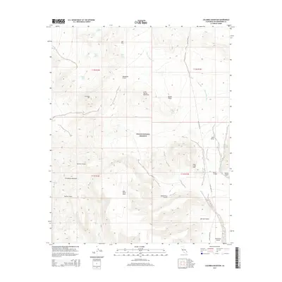
2015 Map of Columbia Mountain
USGS Topo · Published 2015About this map
Mojave National Preserve encompasses this high desert terrain in San Bernardino County, where dramatic elevation changes define the landscape. The Providence Mountains and the Mid Hills dominate the northern and western reaches, while the Little Thorne Mountains rise above the Mojave Desert floor. Water sources are critical markers in this arid environment, with numerous named points including Mexican Water Spring, Silver Lead Spring, and Gold Valley Spring providing life-sustaining hubs. The intricate network of canyons, such as Macedonia Canyon, Beecher Canyon, and Borrego Canyon, reveals the erosive power of seasonal flows like Black Canyon Wash. This map highlights the area's geological complexity, notably at the Hole-in-the Wall formation. Wild Horse Mesa stands as a prominent plateau overlooking the southern drainages of Wild Horse Canyon and Rustler Canyon.
Find a feature on this map
31 named features on this map. Tap any name to fly to it.
Don’t see what you’re looking for? This feature index may not catch every label — zoom into the map to look around manually.
Map Details
Editions of this 2015 Columbia Mountain Map
This is the sole edition of this map. No revisions or reprints were ever made.
Other maps of this area

1910 · Ivanpah
USGS Topo · 1:250,000

1912 · Ivanpah
USGS Topo · 1:250,000

1942 · Ivanpah
USGS Topo · 1:250,000

1942 · Amboy
USGS Topo · 1:250,000

1943 · Amboy
USGS Topo · 1:250,000

1947 · Kingman
USGS Topo · 1:250,000

1948 · Kingman
USGS Topo · 1:250,000

1954 · Needles
USGS Topo · 1:250,000

1954 · Kingman
USGS Topo · 1:250,000

1955 · Kingman
USGS Topo · 1:250,000