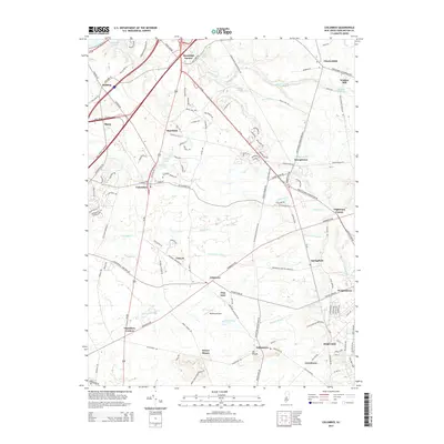
2014 Map of Columbus
USGS Topo · Published 2014About this map
Arneys Mount and Mt Pisgah stand as prominent terrain features in this part of Burlington County, overlooking a landscape defined by traditional crossroads settlements and equestrian-focused land use. The presence of Redwing Airport and the expansive northern reaches of Fort Dix highlight the strategic and logistical importance of the region. Local history is anchored by early milling sites like Wallace Mill and established hamlets such as Columbus, where the Columbus Cem remains a focal point for genealogical research.
Find a feature on this map
117 named features on this map. Tap any name to fly to it.
Don’t see what you’re looking for? This feature index may not catch every label — zoom into the map to look around manually.
Map Details
Editions of this 2014 Columbus Map
This is the sole edition of this map. No revisions or reprints were ever made.
Other maps of this area

1888 · Bordentown
USGS Topo · 1:62,500

1888 · Pemberton
USGS Topo · 1:62,500

1888 · Mount Holly
USGS Topo · 1:62,500

1890 · Burlington
USGS Topo · 1:62,500

1893 · Bordentown
USGS Topo · 1:62,500

1893 · Burlington
USGS Topo · 1:62,500

1894 · Pemberton
USGS Topo · 1:62,500

1894 · Mount Holly
USGS Topo · 1:62,500

1898 · Pemberton
USGS Topo · 1:62,500

1898 · Mount Holly
USGS Topo · 1:62,500
Featured Places
- Bordentown Township, NJ
- Mansfield Township, NJ
- Chesterfield Township, NJ
- Eastampton Township, NJ
- Springfield Township, NJ