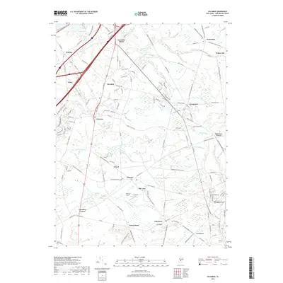
2019 Map of Columbus
USGS Topo · Published 2019About this map
Columbus serves as a central hub in this Burlington County landscape, where traditional settlement patterns meet modern transportation corridors. The village is flanked by the Columbus Cem and a network of arterial roads like Old York Rd and Burlington Pike. To the south, the terrain rises toward Arneys Mount and Mt Pisgah, providing a rare elevation contrast to the low-lying agricultural plains. Smaller hamlets such as Juliustown, Jobstown, and Mansfield Square are connected by winding country lanes that follow the natural contours of the land and its many watercourses.
Find a feature on this map
149 named features on this map. Tap any name to fly to it.
Don’t see what you’re looking for? This feature index may not catch every label — zoom into the map to look around manually.
Map Details
Editions of this 2019 Columbus Map
This is the sole edition of this map. No revisions or reprints were ever made.
Other maps of this area

1888 · Bordentown
USGS Topo · 1:62,500

1888 · Pemberton
USGS Topo · 1:62,500

1888 · Mount Holly
USGS Topo · 1:62,500

1890 · Burlington
USGS Topo · 1:62,500

1893 · Bordentown
USGS Topo · 1:62,500

1893 · Burlington
USGS Topo · 1:62,500

1894 · Pemberton
USGS Topo · 1:62,500

1894 · Mount Holly
USGS Topo · 1:62,500

1898 · Pemberton
USGS Topo · 1:62,500

1898 · Mount Holly
USGS Topo · 1:62,500
Featured Places
- Bordentown Township, NJ
- Mansfield Township, NJ
- Chesterfield Township, NJ
- Eastampton Township, NJ
- Springfield Township, NJ