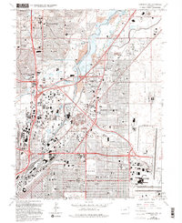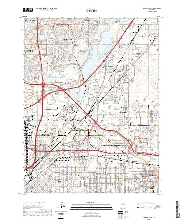
2022 Map of Commerce City
USGS Topo · Published 2022About this map
The South Platte River and its accompanying network of canals and ditches form the industrial and ecological backbone of this corridor north of Denver. This 2022 survey documents the dense urban expansion through Commerce City and Thornton, where historical water-management features like the Burlington Ditch, Lower Clear Cr Canal, and Colorado Agricultural Canal persist alongside modern transit infrastructure. The map provides significant detail for local historians, marking the grounds of Riverside Cem and Rose Hill Cem, alongside academic sites such as the Regis University Thornton Campus. The intersection of nature and industry is visible in the trail systems, including the Sand Creek Greenway Trl and Prairie Gateway Open Space Trl, which navigate the space between established neighborhoods like Derby and the industrial sectors of Irondale.
Find a feature on this map
59 named features on this map. Tap any name to fly to it.
Don’t see what you’re looking for? This feature index may not catch every label — zoom into the map to look around manually.
Map Details
Editions of this 2022 Commerce City Map
This is the sole edition of this map. No revisions or reprints were ever made.