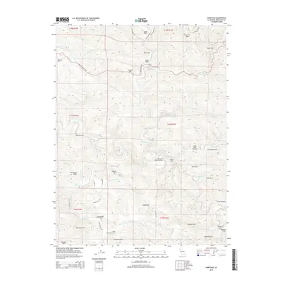
2015 Map of Comptche
USGS Topo · Published 2015About this map
Comptche serves as the central hub of this Mendocino County landscape, where the confluence of the Albion River and its various tributaries dictates the local geography. The area is characterized by a series of high ridges, such as Chamberlain Ridge and Center Ridge, and deep gulches including Railroad Gulch and Portuguese Gulch. A distinctive pattern of upland clearings, labeled as "openings," suggests a history of localized land use or specific geological features, notably Nathaniel Smith Opening and Wild Horse Opening.
Find a feature on this map
58 named features on this map. Tap any name to fly to it.
Don’t see what you’re looking for? This feature index may not catch every label — zoom into the map to look around manually.
Map Details
Editions of this 2015 Comptche Map
This is the sole edition of this map. No revisions or reprints were ever made.
Other maps of this area

1920 · Glenblair
USGS Topo · 1:62,500

1922 · Willits
USGS Topo · 1:62,500

1942 · Willits
USGS Topo · 1:62,500

1943 · Glenblair
USGS Topo · 1:62,500

1943 · Boonville
USGS Topo · 1:62,500

1943 · Navarro
USGS Topo · 1:62,500

1944 · Willits
USGS Topo · 1:62,500

1944 · Saddle Point
USGS Topo · 1:62,500

1957 · Ukiah
USGS Topo · 1:250,000
1959 · Boonville
USGS Topo · 1:62,500