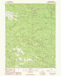
1991 Map of Comptche
USGS Topo · Published 1991About this map
Comptche and the surrounding Mendocino County highlands are shown in detail just before the turn of the 21st century, revealing a landscape defined by industrial forestry and rugged coastal drainages. Much of the northern half of the map is occupied by Jackson State Forest, where the presence of the Chamberlain Creek Conservation Camp and several other remote outposts like North Fork Camp point to the area's ongoing role in resource management. The terrain is deeply incised by the headwaters of major coastal rivers, including the Albion River and Big River, which are fed by a complex network of named gulches and creeks.
Find a feature on this map
45 named features on this map. Tap any name to fly to it.
Don’t see what you’re looking for? This feature index may not catch every label — zoom into the map to look around manually.
Map Details
Editions of this 1991 Comptche Map
This is the sole edition of this map. No revisions or reprints were ever made.
Other maps of this area

1920 · Glenblair
USGS Topo · 1:62,500

1922 · Willits
USGS Topo · 1:62,500

1942 · Willits
USGS Topo · 1:62,500

1943 · Glenblair
USGS Topo · 1:62,500

1943 · Boonville
USGS Topo · 1:62,500

1943 · Navarro
USGS Topo · 1:62,500

1944 · Willits
USGS Topo · 1:62,500

1944 · Saddle Point
USGS Topo · 1:62,500

1957 · Ukiah
USGS Topo · 1:250,000
1959 · Boonville
USGS Topo · 1:62,500