2023 Map of Convoy
USGS Topo · Published 2023About this map
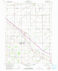
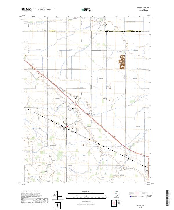
The village of Convoy anchors this section of the western Ohio plains, situated at a historical crossroads where the Lincoln Hwy and the local rail corridor once spurred regional development. The landscape is defined by a dense grid of township roads and agricultural tracts, drained by a network of waterways including Blue Creek, Upper Prairie Creek, and Monkey Run. This concentration of drainage features reflects the engineering required to manage the historically wet prairie lands of Van Wert County.
Find a feature on this map
68 named features on this map. Tap any name to fly to it.
Don’t see what you’re looking for? This feature index may not catch every label — zoom into the map to look around manually.
Map Details
Editions of this 2023 Convoy Map
This is the sole edition of this map. No revisions or reprints were ever made.