2022 Map of Cooleemee
USGS Topo · Published 2022About this map
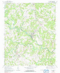
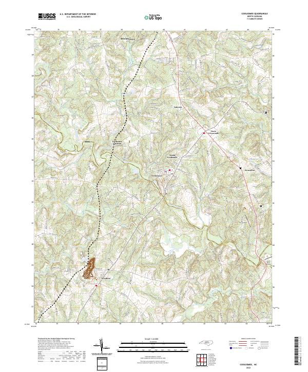
The South Yadkin River carves a winding path through the center of this landscape, serving as the natural boundary between Davie Co and Rowan Co. This territory is anchored by the industrial and residential clusters of Cooleemee and North Cooleemee, where a dense network of local streets such as Center St and Grove St reflects the historical development of these mill-town communities. To the north and south, the terrain opens into a patchwork of rural settlements and family-named homesteads.
Find a feature on this map
145 named features on this map. Tap any name to fly to it.
Don’t see what you’re looking for? This feature index may not catch every label — zoom into the map to look around manually.
Map Details
Editions of this 2022 Cooleemee Map
This is the sole edition of this map. No revisions or reprints were ever made.