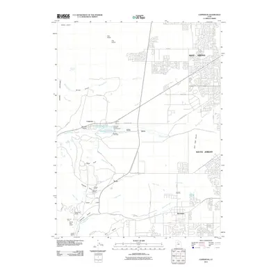
2011 Map of Copperton
USGS Topo · Published 2011About this map
The Oquirrh Mountains form a dramatic western backdrop to the burgeoning residential developments of the Salt Lake Valley in the early 21st century. Industrial water management and mining infrastructure dominate the central landscape near Copperton, evidenced by the Kennecott Eastside Leaching Reservoir and the Bingham Creek Reservoir. The mapping of several subterranean structures, including the Bingham Tunnel, Mascotte Tunnel, and Saint Joe Tunnel, indicates a legacy of deep-earth extraction beneath the canyons. While the eastern portion of the sheet shows the organized suburban expansion of West Jordan and South Jordan, the western foothills remain defined by rugged drainages such as Barneys Canyon and Butterfield Canyon. Smaller locales like Snyder, Dalton, and Robbe sit along the transition between the valley floor and the industrial upland, while the Bingham City Cemetery provides a vital link for those tracing the area's social history.
Find a feature on this map
54 named features on this map. Tap any name to fly to it.
Don’t see what you’re looking for? This feature index may not catch every label — zoom into the map to look around manually.
Map Details
Editions of this 2011 Copperton Map
This is the sole edition of this map. No revisions or reprints were ever made.
Other maps of this area

1885 · Salt Lake
USGS Topo · 1:250,000

1885 · Tooele Valley
USGS Topo · 1:250,000

1915 · Fairfield
USGS Topo · 1:62,500

1917 · Fairfield
USGS Topo · 1:62,500

1925 · Ft. Douglas
USGS Topo · 1:125,000

1928 · Ft. Douglas
USGS Topo · 1:125,000

1951 · Jordan Narrows
USGS Topo · 1:24,000

1951 · Salt Lake City South
USGS Topo · 1:24,000

1951 · Midvale
USGS Topo · 1:24,000

1952 · Magna
USGS Topo · 1:24,000