2023 Map of Copperton
USGS Topo · Published 2023About this map
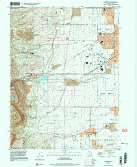
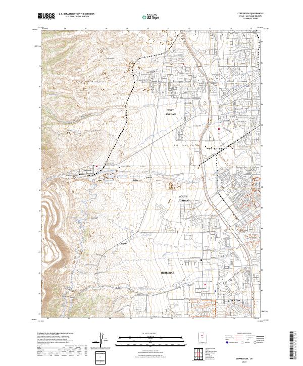
Copperton sits at the foot of the Oquirrh Mountains, where the industrial legacy of Bingham Canyon meets the expanding residential landscape of the Salt Lake Valley. This survey documents a complex geographic transition between heavy mining infrastructure and suburban growth. Large-scale earthworks are visible at the Kennecott Eastside Leaching Reservoir, contrasted with established local landmarks like the Bingham City Cem and the Herriman Cem. The map traces the reach of several small settlements including Robbe, Dalton, and Snyder, as well as the southern neighborhoods of West Jordan and South Jordan. Numerous canyons and gulches, such as Butterfield Canyon and Midas Gulch, carve the western slopes, feeding water into a system of creeks and ditches like the Cement Ditch that once sustained the lower valley's agricultural and mining operations.
Find a feature on this map
173 named features on this map. Tap any name to fly to it.
Don’t see what you’re looking for? This feature index may not catch every label — zoom into the map to look around manually.
Map Details
Editions of this 2023 Copperton Map
This is the sole edition of this map. No revisions or reprints were ever made.