Loading...
Loading map...2021 Map of Cora
USGS Topo · Published 2021About this map
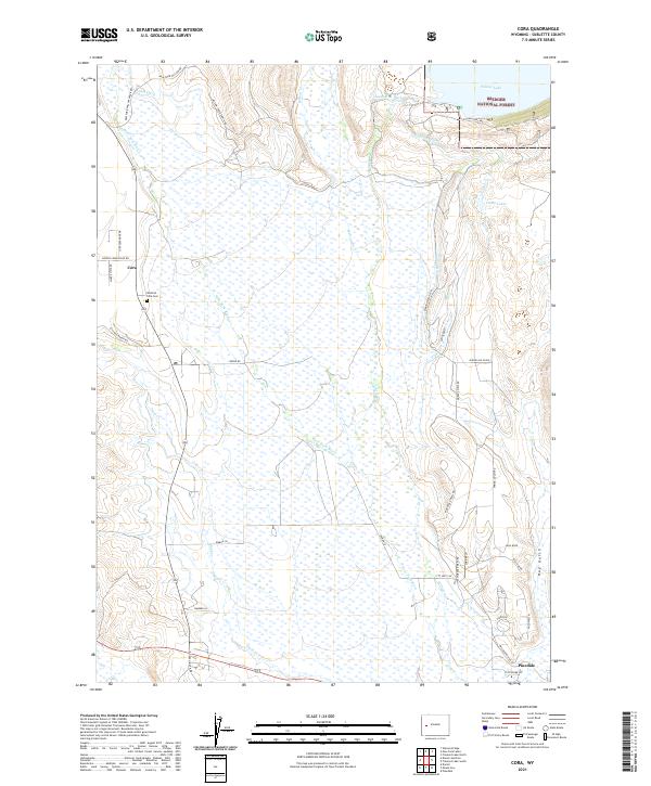
Cora sits at the heart of this landscape, where the high plains meet the southwestern edge of the Bridger National Forest. The area is defined by an intricate network of water management, with Highline Ditch, Binning Ditch, and Rahm Ditch lacing across the terrain to support ranching operations. These man-made channels diverge from the natural course of the New Fork River and Duck Cr, illustrating the long-standing irrigation heritage of Sublette County.
Find a feature on this map
42 named features on this map. Tap any name to fly to it.
Don’t see what you’re looking for? This feature index may not catch every label — zoom into the map to look around manually.
Map Details
Date Portrayed2021
Date Published2021
PublisherU.S. Geological Survey
Map TypeTopographic
Scale1:24000
Physical Dimensions24 x 29 inches
Editions of this 2021 Cora Map
This is the sole edition of this map. No revisions or reprints were ever made.
Historical Maps of Cora Through Time

Featured Locations
Source Details
SourceU.S. Geological Survey
CopyrightPublic Domain