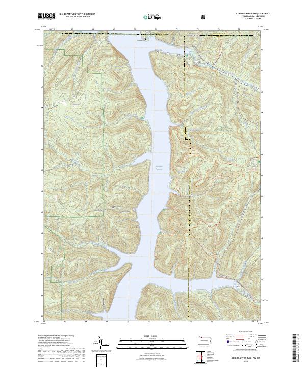
2023 Map of Cornplanter Run
USGS Topo · Published 2023About this map
The Allegheny Reservoir dominates the center of this landscape, its fingers reaching into deep drainages along the border of Pennsylvania and New York. This modern survey illustrates the heavily forested character of the Allegheny National Forest, where a complex network of recreational paths such as the North Country National Scenic Trail and Tracy Ridge Hiking Trail thread through the hills. On the western shore, Quaker Ridge and Roper Hollow provide a sense of the upland topography, while the northern edge is marked by the Riverview Cemetery near the state line. Numerous small waterways, including Cornplanter Run, Johnnycake Run, and Willow Creek, carve out named hollows like Schoolhouse Hollow, showing how the terrain has been shaped by the watershed long before the reservoir was filled.
Find a feature on this map
48 named features on this map. Tap any name to fly to it.
Don’t see what you’re looking for? This feature index may not catch every label — zoom into the map to look around manually.
Map Details
Editions of this 2023 Cornplanter Run Map
This is the sole edition of this map. No revisions or reprints were ever made.
Other maps of this area

1905 · Jamestown
USGS Topo · 1:62,500

1906 · Warren
USGS Topo · 1:62,500

1907 · Warren
USGS Topo · 1:62,500

1908 · Warren
USGS Topo · 1:62,500

1922 · Randolph
USGS Topo · 1:62,500

1923 · Randolph
USGS Topo · 1:62,500

1936 · Kinzua
USGS Topo · 1:48,000

1941 · Kinzua
USGS Topo · 1:62,500

1942 · Jamestown
USGS Topo · 1:62,500

1943 · Randolph
USGS Topo · 1:62,500