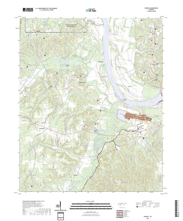
2022 Map of Counce
USGS Topo · Published 2022About this map
The Shiloh National Battlefield dominates the northern landscape of this Hardin County quadrangle, preserving the historic ground of Fraley Field. The Tennessee River serves as the central geographic spine, flowing north toward Kentucky Lake and shaping the development of riverside settlements like Hamburg and Pyburn. The terrain is deeply etched by a network of waterways including the Lick Creek Canal, Chambers Creek, and numerous family-named branches and creeks that define the rural character of the region.
Find a feature on this map
147 named features on this map. Tap any name to fly to it.
Don’t see what you’re looking for? This feature index may not catch every label — zoom into the map to look around manually.
Map Details
Editions of this 2022 Counce Map
This is the sole edition of this map. No revisions or reprints were ever made.
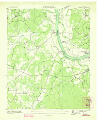
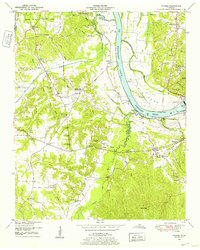
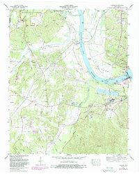
Historical Maps of Nixon Through Time
4 maps found