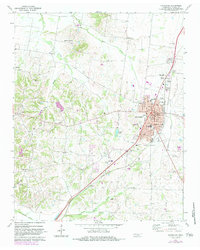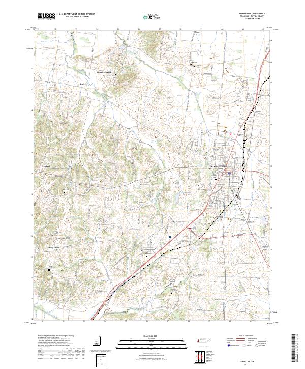
2022 Map of Covington
USGS Topo · Published 2022About this map
The county seat of Covington serves as the primary hub for this Tipton County landscape, where urban infrastructure meets the winding tributaries of the Mississippi River basin. The map reveals a high concentration of burial grounds and small communities like Mount Lebanon and Holly Grove, indicating a deeply rooted rural settlement pattern. Significant local institutions, including the Tipton County Justice Center and Dyersburg State Community College, are clustered within the city limits, while the surrounding terrain is defined by the drainage of Mathis Cr and Town Cr. The presence of numerous family-named landmarks such as Walton Cem and Avery Cem provides invaluable data for genealogists tracing regional lineages. To the southwest, the Indian Creek Canal represents a major hydrological modification to the natural bottomlands, contrasting with the untouched meanders of Smith Br and Rocky Br found throughout the quadrangle.
Find a feature on this map
147 named features on this map. Tap any name to fly to it.
Don’t see what you’re looking for? This feature index may not catch every label — zoom into the map to look around manually.
Map Details
Editions of this 2022 Covington Map
This is the sole edition of this map. No revisions or reprints were ever made.