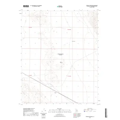
2018 Map of Cowhole Mountain
USGS Topo · Published 2018About this map
The Mojave National Preserve encompasses most of this arid landscape, dominated by the stark elevation of Cowhole Mtn in the north and the shifting sands of the Devils Playground to the south. This terrain is shaped by the ephemeral course of Kelso Wash, which cuts across the southwestern portion of the map. Human infrastructure is concentrated along the southern corridor where the Union Pacific railroad tracks parallel the wash, serving as a vital transportation artery through the eastern Mojave Desert. The small settlement of Sands sits along this rail line, representing a isolated outpost in a region defined by its extreme topography and protected wilderness status. The survey clearly delineates the township and range lines, including t12n r9e and t11n r10e, marking the legal grid over the open desert floor.
Find a feature on this map
11 named features on this map. Tap any name to fly to it.
Don’t see what you’re looking for? This feature index may not catch every label — zoom into the map to look around manually.
Map Details
Editions of this 2018 Cowhole Mountain Map
This is the sole edition of this map. No revisions or reprints were ever made.
Other maps of this area

1910 · Ivanpah
USGS Topo · 1:250,000

1912 · Ivanpah
USGS Topo · 1:250,000

1933 · Avawatz Mountains
USGS Topo · 1:250,000

1942 · Ivanpah
USGS Topo · 1:250,000

1942 · Amboy
USGS Topo · 1:250,000

1943 · Amboy
USGS Topo · 1:250,000

1947 · Trona
USGS Topo · 1:250,000

1947 · Kingman
USGS Topo · 1:250,000

1948 · Kingman
USGS Topo · 1:250,000

1948 · Trona
USGS Topo · 1:250,000